Artwork
Looking South into the Grand Canyon, Colorado River, Sheavwitz
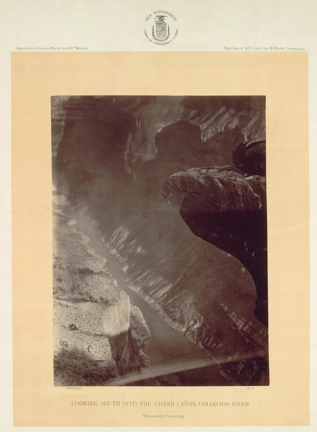
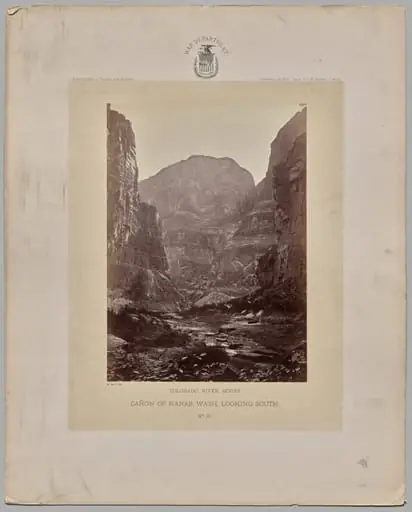
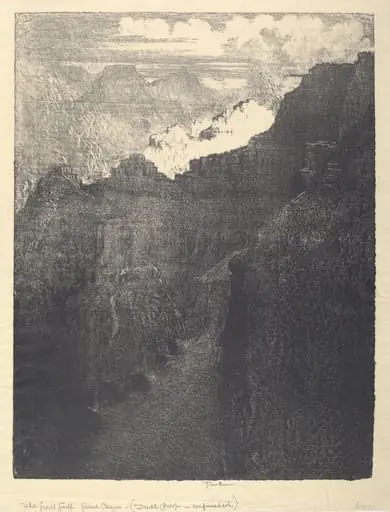
Looking South into the Grand Canyon, Colorado River, Sheavwitz is a photography by the Impressionist artist William H. Bell. It dates from 1872 and is held in the collection of the Cleveland Museum of Art. Taken between 1871 and 1873, this photograph was made during the U.
About this work
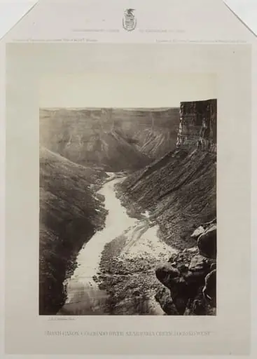
This painting shows a dramatic view of the Grand Canyon.
The artist took this photo during a government survey of lands west of the 100th meridian. He used a special technique to take pictures without a darkroom, which was helpful on the expedition.
He used this freedom to create dramatic compositions, check out the work of artist: William H. Bell (American, 1830–1910)
Overview
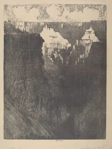
Bell, the expedition’s photographer, captured the Grand Canyon’s depth using dry plate technology he developed himself.
Taken between 1871 and 1873, this photograph was made during the U.S. government’s Western surveys led by General George M. Wheeler. William H. Bell, the expedition’s photographer, captured the Grand Canyon’s depth using dry plate technology he developed himself. This method eliminated the need for a portable darkroom, allowing greater mobility in remote terrain. The image reflects both scientific documentation and a deliberate aesthetic approach to the landscape.
Subject & Meaning
The photograph presents a vertiginous view southward into the Grand Canyon, with the Colorado River visible far below. Jutting rocks in the foreground ground the viewer’s gaze, intensifying the sense of descent. The composition conveys the overwhelming scale of the canyon, not as a mere geographical feature but as a physical experience—emphasizing the viewer’s position on the rim, confronting the immensity of erosion and time.
Technique & Style
Bell employed dry plate photography, a relatively new technique that allowed exposures without immediate chemical processing. This gave him flexibility in the field, unlike the cumbersome wet collodion method. His compositions often stressed verticality and dramatic lighting, using stark contrasts between sunlit rims and shadowed chasms to heighten spatial depth and convey the canyon’s geological power.
History & Provenance
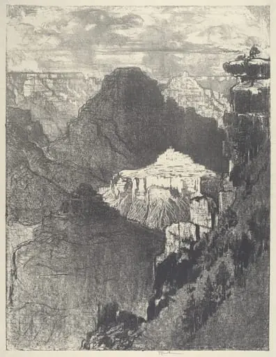
The photograph originated as part of the U.S. Geological and Geographical Survey of the Territories, a federal initiative to map western lands. Bell’s images were among the first detailed visual records of the Grand Canyon, later used in government reports and public exhibitions. The original plates were archived by the U.S. Geological Survey, ensuring their preservation and scholarly use.
Context
During the post-Civil War era, federal surveys sought to document and assess western territories for potential development and resource extraction. Photography became a key tool for scientific and political purposes. Bell’s work aligned with broader efforts to translate unfamiliar landscapes into comprehensible images for eastern audiences, blending empirical observation with visual rhetoric.
Legacy
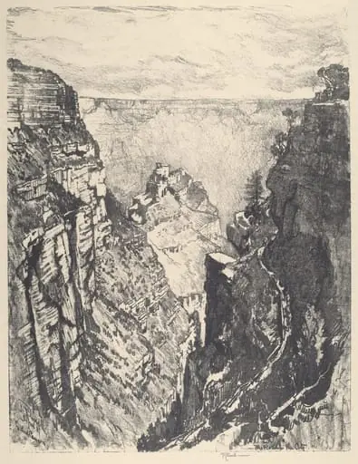
Bell’s photographs contributed to the early visual canon of the American West, influencing how the Grand Canyon was perceived before it became a national park. His technical innovation and compositional rigor set a standard for landscape photography in scientific expeditions. Though less widely known than contemporaries like Timothy O’Sullivan, his images remain critical records of 19th-century survey practices.
Artist & collection