Artwork
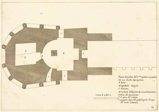
Plan of All the Important Places in Bethlehem
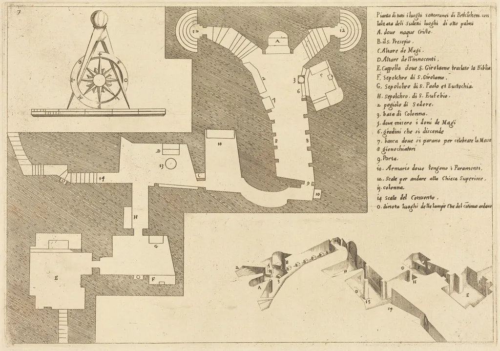
Plan of All the Important Places in Bethlehem is an ink print by the Baroque artist Jacques Callot. It dates from 1619 and is held in the collection of the National Gallery of Art.
About this work
Overview
The restrike preserves the original’s fine lines and intricate labeling, reflecting its function as both a devotional aid and a documentary record.
This print, created by Jacques Callot in 1619, is a detailed topographical representation of Bethlehem’s sacred sites. Executed in etching and engraving on laid paper, it belongs to a series of over 1,400 prints produced by the French artist. Unlike narrative scenes common in his oeuvre, this work prioritizes spatial accuracy, mapping religious architecture with cartographic clarity. The restrike preserves the original’s fine lines and intricate labeling, reflecting its function as both a devotional aid and a documentary record.
Subject & Meaning
The print identifies key locations associated with Christian tradition in Bethlehem, including chapels, altars, and burial sites. Each feature is marked with Italian terminology and alphabetical labels, guiding viewers through the sacred geography. The inclusion of a compass rose suggests orientation for pilgrims or scholars. Rather than depicting events, the image serves as a guide to holy spaces, reinforcing their physical presence and spiritual significance through precise notation and layout.
Technique & Style
Callot employed fine-line etching and engraving to render architectural details with exceptional clarity. Walls, staircases, and doorways are delineated with uniform precision, creating a diagrammatic effect akin to a technical blueprint. The use of numbered labels and Italian terms reflects a scholarly approach, blending cartographic convention with ecclesiastical documentation. The absence of shading or perspective distortion emphasizes function over aesthetics, aligning the work with early modern surveying practices.
History & Provenance
Produced in 1619, the print was likely intended for distribution among clergy, pilgrims, or patrons interested in the Holy Land. As a restrike, it derives from the original copper plate, preserved and reprinted in later decades. Its survival in multiple impressions indicates sustained interest in Bethlehem’s sacred architecture. The work’s survival in institutional collections suggests early recognition of its value as a documentary artifact rather than purely artistic output.
Context
In the early 17th century, European interest in the geography of biblical sites intensified due to religious pilgrimage and Counter-Reformation efforts. Callot’s print aligns with a broader trend of producing accurate depictions of holy places, often based on traveler accounts or existing plans. Unlike imaginative renderings, this work prioritizes measurable space, reflecting a growing emphasis on empirical observation in both religious and scientific circles of the period.
Legacy
Callot’s Bethlehem plan stands as an early example of architectural documentation in print form, influencing later cartographic and ecclesiastical illustrations. Its methodical labeling and spatial fidelity set a precedent for religious topographies in the 17th and 18th centuries. Though not widely exhibited as art, it remains a significant reference in studies of sacred geography, pilgrimage culture, and the intersection of print technology with religious practice.
Artist & collection
Artist
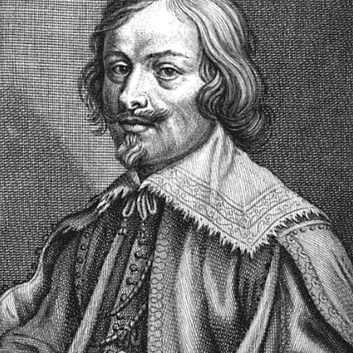
Jacques Callot was a baroque printmaker and draftsman from the Duchy of Lorraine.

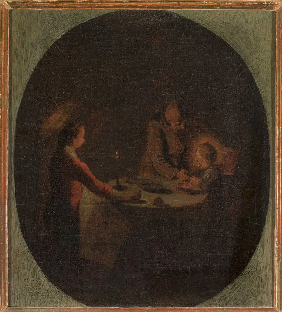 Holy Family at supper
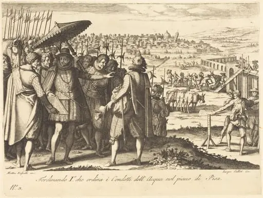 Restoration of the Aqueduct at Pisa
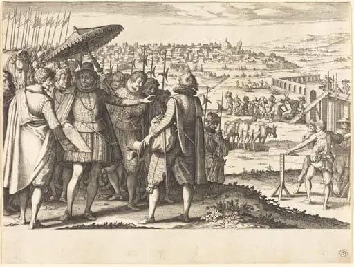 Restoration of the Aqueduct at Pisa
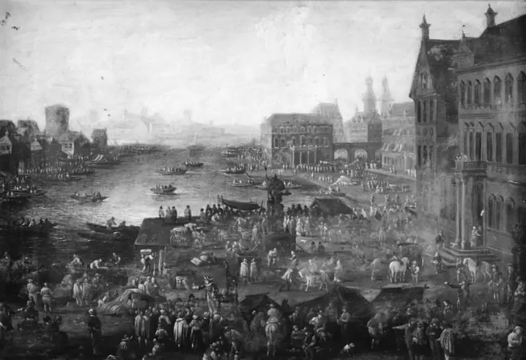 Square in Paris with Many Figures
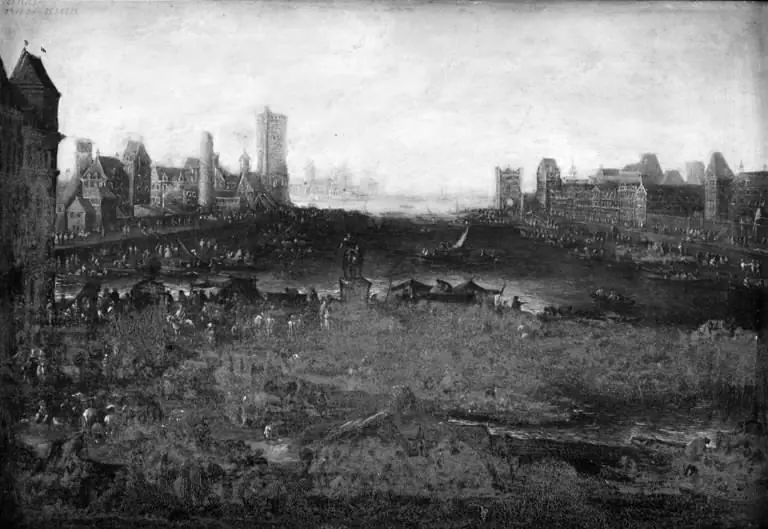 Square in Paris with Many Figures
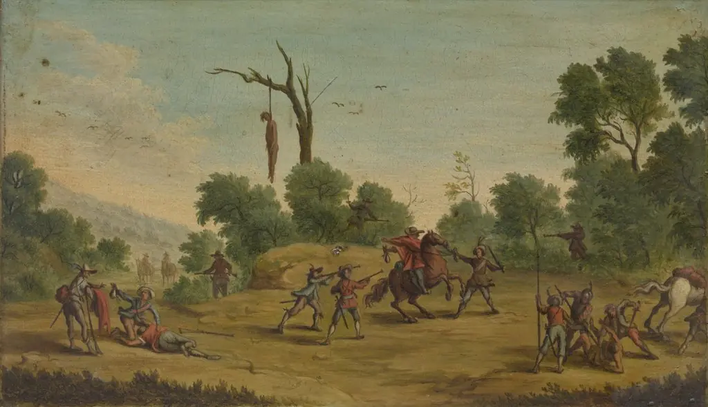 Horsemen Attacked by Robbers
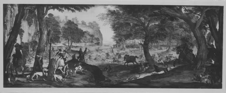 HOW WILL A COVERED PART BE CORRECTED?HOW WIKA A COVERED HEART DEED CORRECTED?
![Christ Walking on the Water [second plate], by Jacques Callot](https://artifactworldgallery.com/img/jacques-callot--christ-walking-on-the-water-second-plate--2069f3bfe4cb2126-w320.webp) Christ Walking on the Water [second plate]
Christ Walking on the Water [second plate]
 Plan of the Church of the Holy Sepulchre
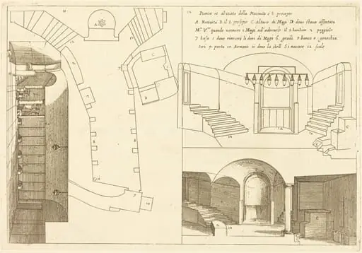 Plan and Elevation of the Church of the Holy Nativity
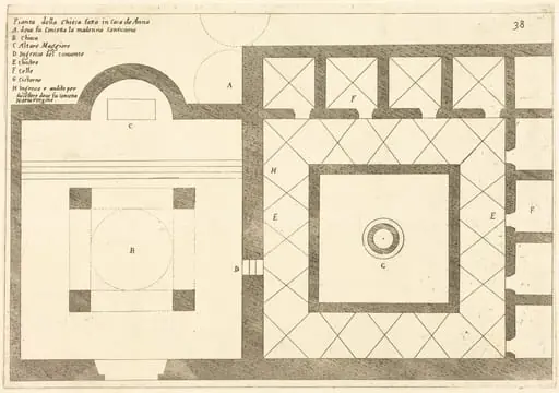 Plan of the Church near the House of Annas
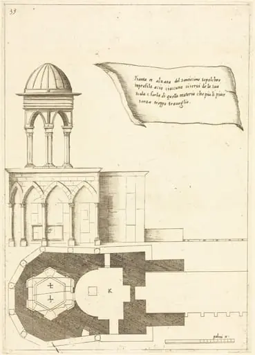 Plan and Elevation of the Church of the Holy Sepulchre
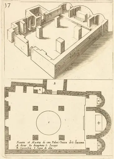 Plan and Elevation of the Church of S. Iacoma
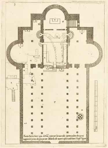 Plan of the Church of the Holy Manger
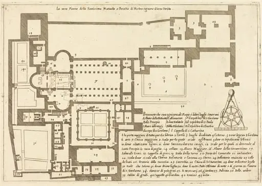 Plan of the Church of the Holy Nativity
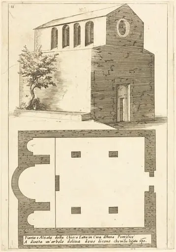 Plan and Elevation of the Church near the House of Annas
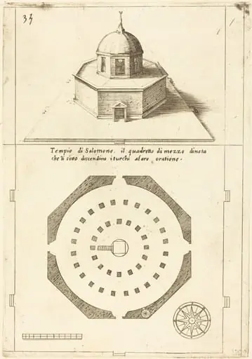 Plan and Rendering of the Temple of Solomon
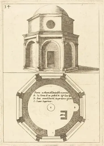 Plan and Elevation of the Church of the Ascension