Artwork
Novi Belgii Novaeque Angliae nec non Pennsylvaniae et partis Virginiae tabula multis in locis emendata
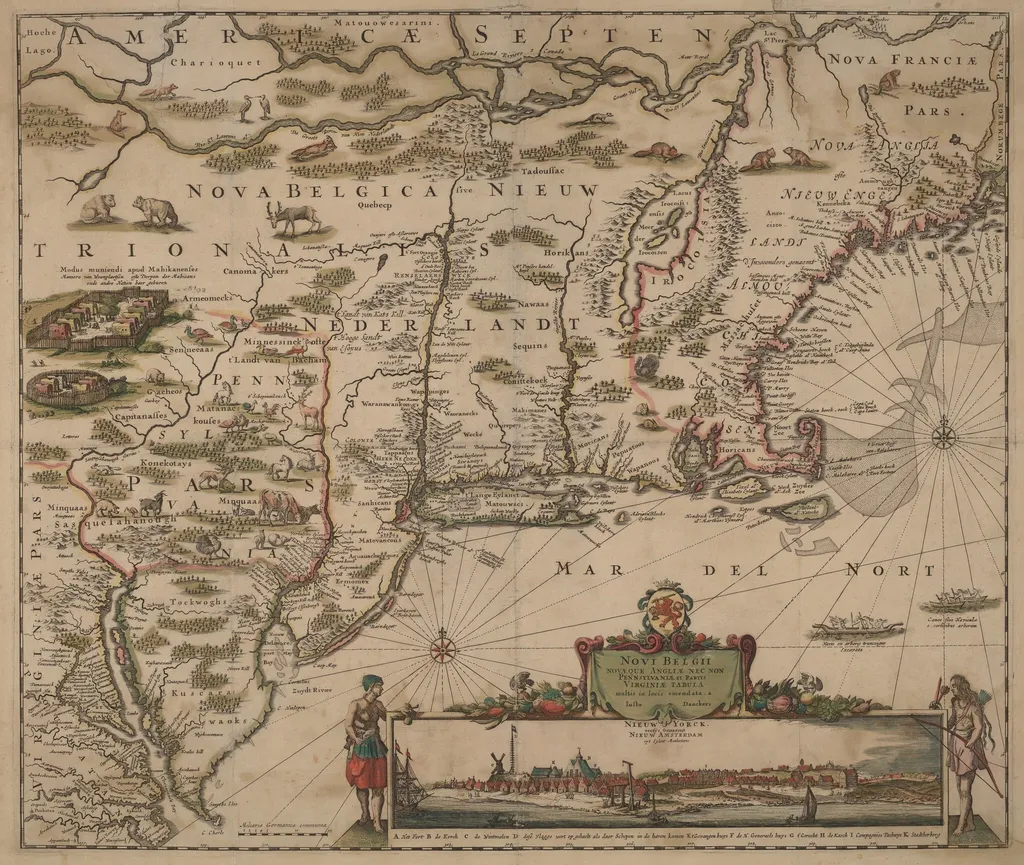
Novi Belgii Novaeque Angliae nec non Pennsylvaniae et partis Virginiae tabula multis in locis emendata is an ink print by the Baroque artist Justus Danckerts. It dates from 1684 and is held in the collection of the National Gallery of Art. Created around 1684, this hand‑colored engraving on laid paper presents a detailed representation of the eastern seaboard of North America.
About this work
Overview
Created around 1684, this hand‑colored engraving on laid paper presents a detailed representation of the eastern seaboard of North America. The work, titled in Latin to denote New York, New England, Pennsylvania, and parts of Virginia, combines cartographic precision with decorative coloration, offering a view of the region as it was understood in the late seventeenth century.
Subject & Meaning
The map delineates coastlines, major rivers, and settlements that were significant to European colonists and indigenous peoples at the time. By marking towns, harbors, and geographic features, it served both as a navigational aid and as a visual assertion of territorial claims, reflecting contemporary interests in trade, settlement, and political control.
Technique & Style
Engraved by the Dutch cartographer Justus Danckerts, the image was produced through incising lines into a copper plate, then printing onto laid paper. Hand‑coloring was applied after printing, enhancing the delineation of land, water, and political boundaries. The style balances scientific accuracy with ornamental elements typical of late‑Baroque cartography.
History & Provenance
The work originates from the Danckerts family workshop, a prominent Dutch publishing house active in the 17th century. Copies circulated among European collectors and colonial administrators, contributing to the spread of geographic knowledge about the New World. The surviving specimen is dated to circa 1684, aligning with a period of intensified mapping of North American colonies.
Artist & collection


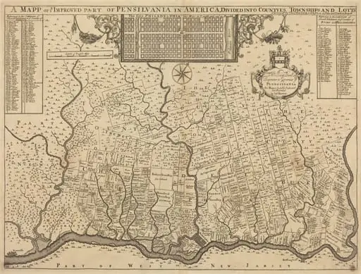 A mapp of ye improved part of Pensilvania in America, divided into countyes, townships and lotts
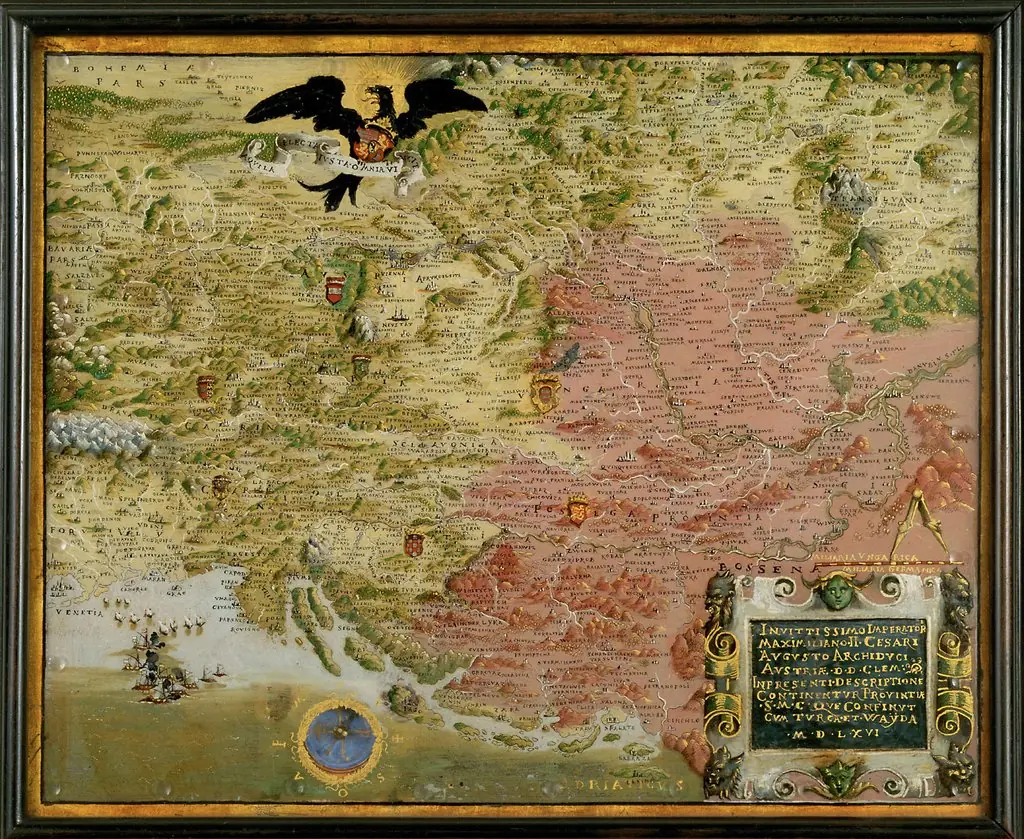 Landkarte der habsburgischen Erblande mit Kompaß (Karte des österreichisch-türkischen Kriegsschauplatzes)
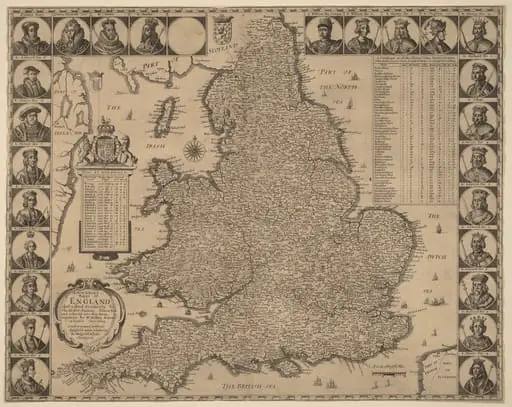 A New and Exact Mappe of England
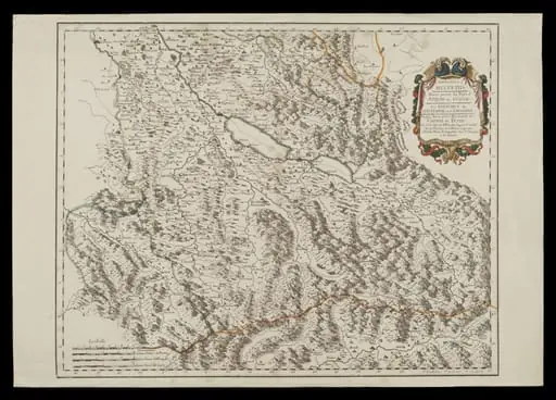 H Beard Print Collection
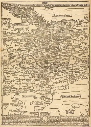 Road Map of Central Europe
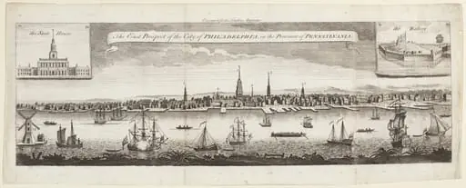 The East Prospect of the City of Philadelphia, in the Province of Pennsylvania
 New York et Brooklyn - Vue prise au dessus dela batterie
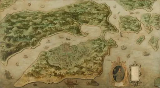 Gezicht op Ambon
![View of Venice [lower left block], by Jacopo de' Barbari](https://artifactworldgallery.com/img/jacopo-de-barbari--view-of-venice-lower-left-block--b7faa7641398e98e-w320.webp) View of Venice [lower left block]
View of Venice [lower left block]![The Siege of La Rochelle [plate 12 of 16; set comprises 1952.8.97-112], by Jacques Callot](https://artifactworldgallery.com/img/jacques-callot--the-siege-of-la-rochelle-plate-12-of-16-set-comprises-1952-8--11aa44a7ba7b84a3-w320.webp) The Siege of La Rochelle [plate 12 of 16; set comprises 1952.8.97-112]
The Siege of La Rochelle [plate 12 of 16; set comprises 1952.8.97-112]![The Siege of La Rochelle [plate 10 of 16; set comprises 1952.8.97-112], by Jacques Callot](https://artifactworldgallery.com/img/jacques-callot--the-siege-of-la-rochelle-plate-10-of-16-set-comprises-1952-8--ab099ebe6617f96c-w320.webp) The Siege of La Rochelle [plate 10 of 16; set comprises 1952.8.97-112]
The Siege of La Rochelle [plate 10 of 16; set comprises 1952.8.97-112] Frontispiece