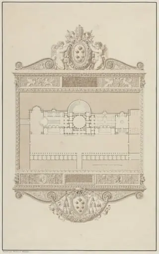
Artwork
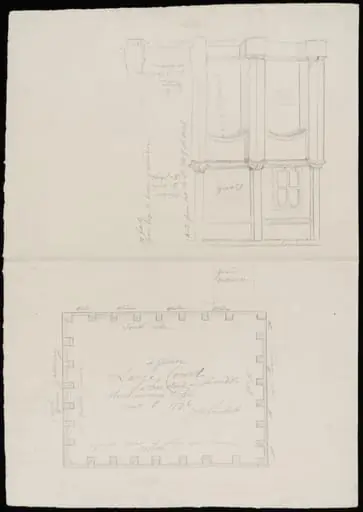
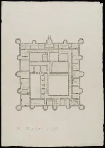
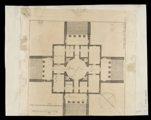
Ground plan, giving dimensions.
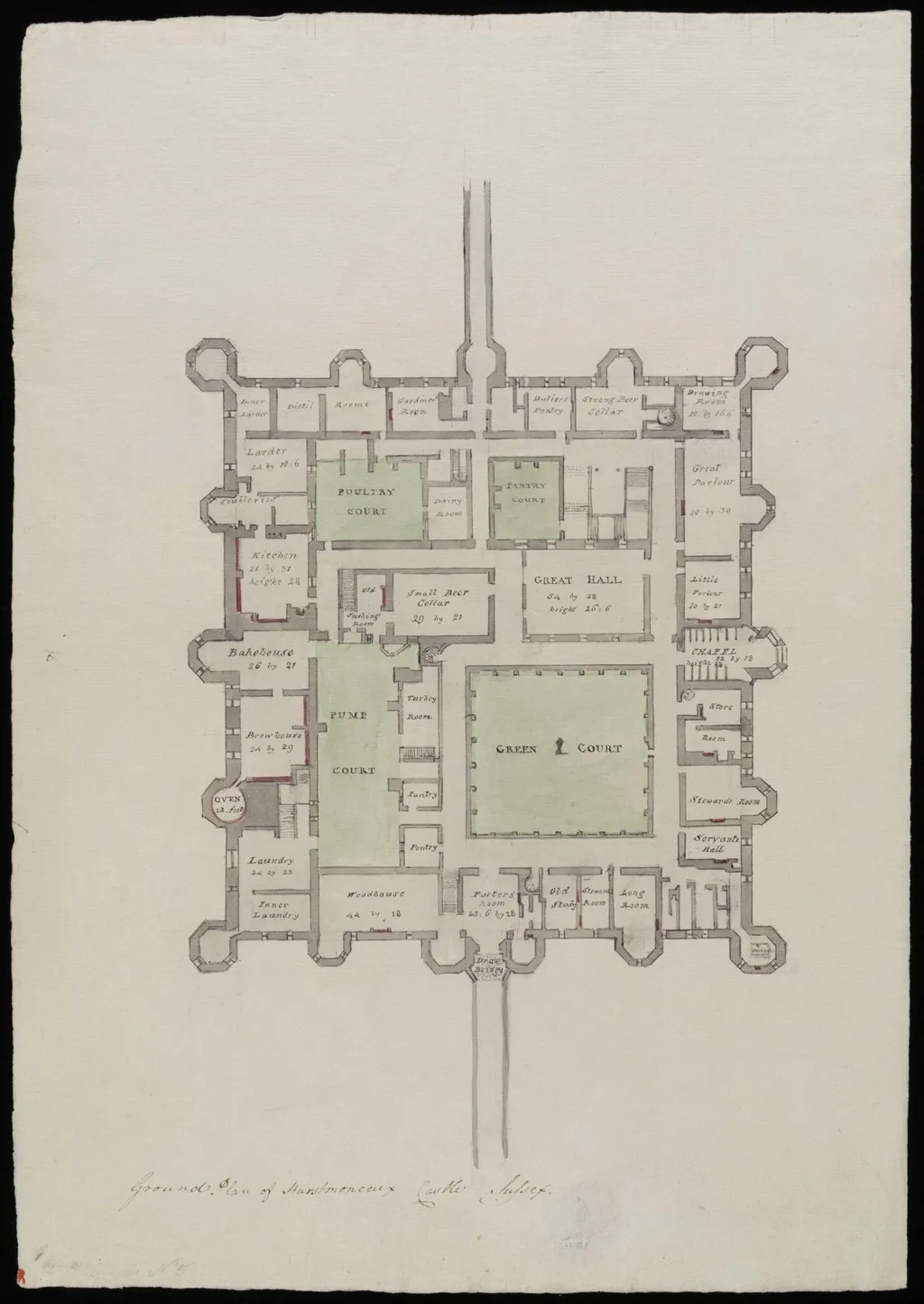
Ground plan, giving dimensions. is a drawing by the Romanticist artist James Lambert senior. It dates from 1776 and is held in the collection of the Victoria and Albert Museum.
About this work
Overview
All elements—walls, doorways, rooms, and fixtures—are annotated with measurements, indicating its function as a technical record rather than a decorative piece.
This 1776 architectural drawing by James Lambert senior presents a precise floor plan of a castle, rendered in ink on paper. All elements—walls, doorways, rooms, and fixtures—are annotated with measurements, indicating its function as a technical record rather than a decorative piece. The work is held in the Victoria and Albert Museum’s collection, where it serves as a document of domestic and structural design from the late 18th century.
Subject & Meaning
The plan depicts the internal layout of a fortified residence, identifying key spaces such as the Great Hall, kitchen, and courtyards. Its purpose was utilitarian: to communicate spatial relationships and dimensions for construction or renovation. The inclusion of specific features like an oven suggests attention to functional detail, reflecting the priorities of domestic life and estate management in the period.
Technique & Style
Executed in fine black ink, the drawing employs clean, hand-drawn lines with minimal shading to distinguish architectural elements. Measurements are inscribed directly beside each room, emphasizing accuracy over aesthetics. The draftsmanship is methodical, with consistent scale and clear labeling, characteristic of professional architectural documentation of the time, though lacking ornamental embellishment.
History & Provenance
Created in 1776, the drawing was likely produced for an estate owner or builder seeking to record or modify existing structures. It entered the Victoria and Albert Museum’s collection as part of its broader archive of British architectural drawings, preserved for its insight into pre-industrial building practices and the role of professional surveyors like Lambert.
Context
In the late 18th century, detailed floor plans were essential tools for managing country estates, especially as architectural standards evolved. James Lambert senior was among the surveyors who documented historic buildings, often for clients interested in preservation or modernization. This drawing reflects the growing professionalization of architectural practice outside London’s elite circles.
Legacy
As a surviving example of practical architectural drafting from the Georgian era, the plan offers scholars a window into the technical methods and spatial priorities of its time. It contributes to the understanding of how domestic architecture was recorded and transmitted before standardized drafting conventions became universal.
Artist & collection
Artist
James Lambert senior drew precise sketches of buildings in 1776. His pencil lines map a grand house’s halls, kitchens, and floor plans with everyday dates—“Aug 6th,” “Nov 1st,” “Dec 12th”—as if recording a house under…