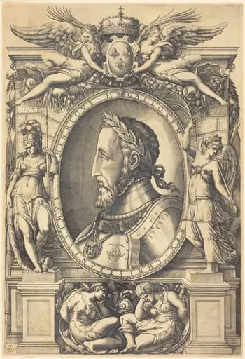
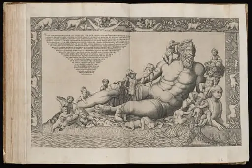
Artwork
Topographical Map of Ancient Rome
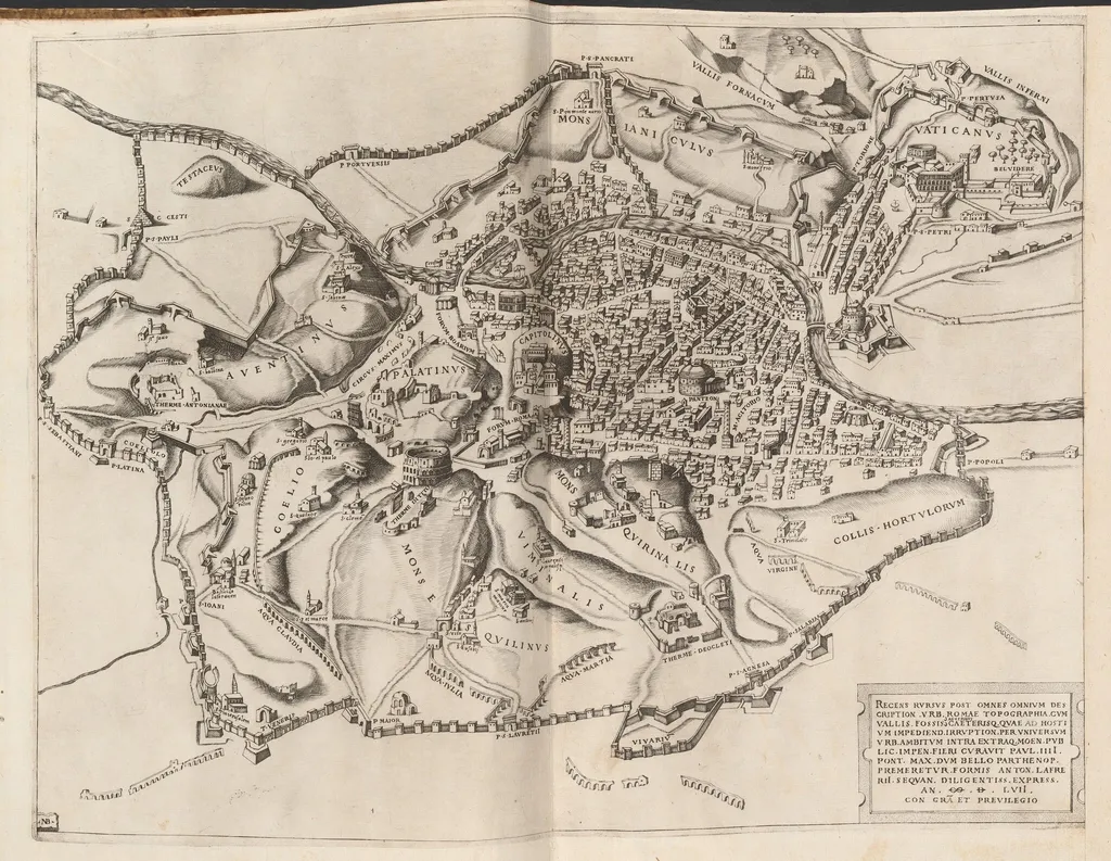
Topographical Map of Ancient Rome is an ink print by the Renaissance artist Nicolas Beatrizet. It dates from 1557 and is held in the collection of the National Gallery of Art. Created in 1557, this black‑and‑white engraving presents a detailed topographical representation of ancient Rome.
About this work
Overview
Created in 1557, this black‑and‑white engraving presents a detailed topographical representation of ancient Rome. The composition charts the city's hills, streets, walls, and waterways, punctuated with concise labels such as “Capitol” and “Palatine.” The dense arrangement of miniature structures conveys the urban complexity of the imperial capital.
Subject & Meaning
The print functions as a visual guide to Rome’s historic landscape, identifying major topographical features and civic landmarks. By marking the locations of temples, forums, and defensive walls, it offers viewers a spatial understanding of how religious, political, and residential zones intersected in the ancient metropolis.
Technique & Style
Nicolas Beatrizet employed the engraving process, incising fine, parallel lines into a metal plate to achieve precise delineation of streets and architectural outlines. The delicate hatching creates tonal variation, allowing subtle differentiation between terrain elevations, watercourses, and built forms—a level of cartographic detail uncommon in mid‑sixteenth‑century prints.
History & Provenance
The work originates from the French engraver Nicolas Beatrizet, active in the mid‑1500s. Though specific ownership records are scarce, the print reflects the period’s growing scholarly interest in antiquarian studies and the dissemination of classical knowledge through printed media.
Context
Produced during the Renaissance, the engraving aligns with a broader revival of interest in Roman antiquity. Scholars and artists of the era sought accurate visual references for archaeological research, and such maps served both educational and decorative purposes within humanist circles.
Legacy
While not widely reproduced, the map exemplifies early modern attempts to render ancient urbanism with cartographic precision. Its methodological approach influenced later topographical prints and contributed to the evolving visual vocabulary used to study and teach Roman history.
Artist & collection


![Castello S. Angelo di Roma [Castel Sant'Angelo in Rome], by Nicolas Beatrizet](https://artifactworldgallery.com/img/nicolas-beatrizet--castello-s-angelo-di-roma-castel-sant-angelo-in-rome--6c77d3bfe127c436-w320.webp)
![Pantheum Romanum [The Roman Pantheon], by Nicolas Beatrizet](https://artifactworldgallery.com/img/nicolas-beatrizet--pantheum-romanum-the-roman-pantheon--8069db7dd8e6f190-w320.webp)
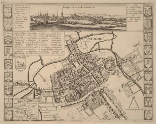 Prospect of Oxford
![The Siege of Breda [plate 3 of 6], by Jacques Callot](https://artifactworldgallery.com/img/jacques-callot--the-siege-of-breda-plate-3-of-6--c43bd4a835426ed7-w320.webp) The Siege of Breda [plate 3 of 6]
The Siege of Breda [plate 3 of 6]![The Siege of La Rochelle [plate 6 of 16; set comprises 1952.8.97-112], by Jacques Callot](https://artifactworldgallery.com/img/jacques-callot--the-siege-of-la-rochelle-plate-6-of-16-set-comprises-1952-8--87e690454dc011ee-w320.webp) The Siege of La Rochelle [plate 6 of 16; set comprises 1952.8.97-112]
The Siege of La Rochelle [plate 6 of 16; set comprises 1952.8.97-112]![The Siege of La Rochelle [plate 7 of 16; set comprises 1952.8.97-112], by Jacques Callot](https://artifactworldgallery.com/img/jacques-callot--the-siege-of-la-rochelle-plate-7-of-16-set-comprises-1952-8--ed3ab4aaddd2281d-w320.webp) The Siege of La Rochelle [plate 7 of 16; set comprises 1952.8.97-112]
The Siege of La Rochelle [plate 7 of 16; set comprises 1952.8.97-112]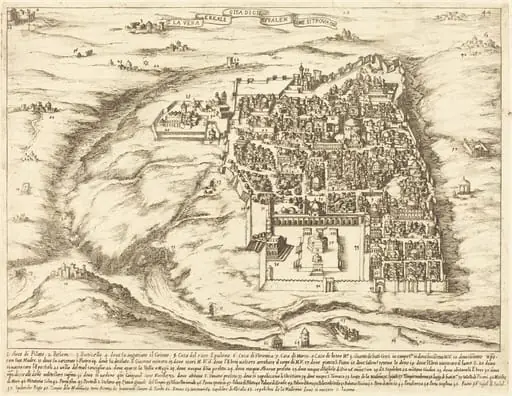 Aerial View of the City of Jerusalem
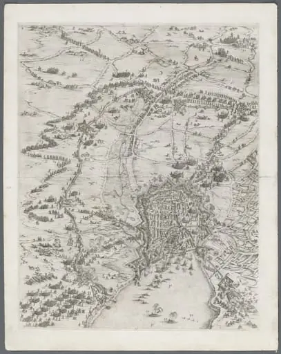 The Siege of La Rochelle: Plate 6
 Untitled
 Map of Vienna
 The Siege of La Rochelle: Plate 12
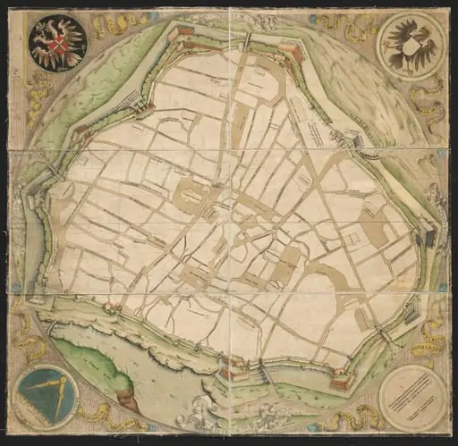 Map of Vienna
![The Siege of Breda [plate 4 of 6], by Jacques Callot](https://artifactworldgallery.com/img/jacques-callot--the-siege-of-breda-plate-4-of-6--3e777c648194dcba-w320.webp) The Siege of Breda [plate 4 of 6]
The Siege of Breda [plate 4 of 6]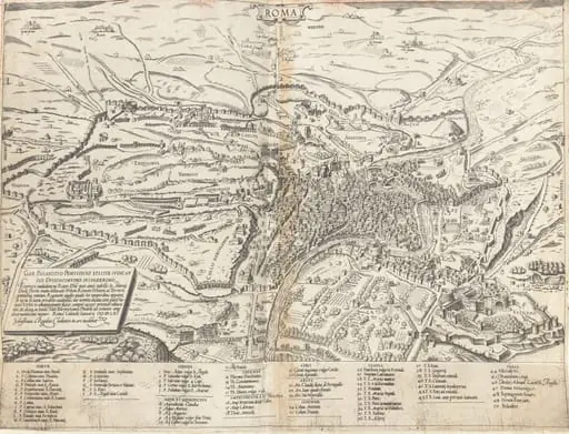 Topographical Map of Modern Rome